
In the northern West Bank, north of Tapuah Junction, there is a relatively new bypass road that goes around the Arab town of Hawara. There was a time when there were frequent clashes in Hawara, including a number attacks on Israelis. Now, the bypass road shifts the Israeli traffic to a route around the large Palestinian town.
This is the northern part of Route 60, the route that historically connects the entire West Bank from north to south. However, much of that historic route has been changed because of the political changes here, with Jewish and Arab communities divided.
On the bypass road, there is a place on the map marked as “Luna Park.” It was once a more active amusement park. From the road, the old Ferris wheel and other rides can be seen, many of them coated in chipped paint and rust. It’s like a museum of an amusement park. It’s an example of the old and the new here: the Arab villages, the new road, and above it all the ancient hills of Samaria. Mount Ebal and Mount Gerizim loom over the landscape, framing the city of Nablus. Both are sites of biblical importance.
A DECADE ago, I took a drive to find the ruins of the ancient city of Samaria, the capital of what was once the Kingdom of Israel. The site is well known and is located near the city of Nablus in the northern West Bank, Shomron. In fact, the city of Samaria gives its name to the area. A decade ago, the way to access this site was through a Palestinian village called Sebastia. One of the roads nearby had a sign saying USAID had contributed to it. It was supposed to be an Israeli national park, but it had long been closed. The site was in disrepair, with ancient walls and parts of the ruins of a once great city poking from beneath collapsed walls and trees.
The Israeli government has been saying it wants to redevelop the site. There has been excavation and conservation work, according to reports from 2025. We reported in February that the Knesset Education, Culture and Sports Committee had “approved the advancement of a controversial bill to establish a West Bank Heritage Authority to oversee antiquities and heritage sites in the West Bank.” Supposedly, around NIS 30 million was going to be put aside for this. Today, the website of the Israel National Parks Authority notes that access to Sebastia, or Tel Shomron, requires coordination and approval from the IDF.
The drive to the Shomron takes about an hour north of Jerusalem
“Tel Shomron preserves the remains of the city of Samaria, the capital of the Kingdom of Israel, and the magnificent remains of the city of Sebastia – the city founded by Herod during the Roman period and which became one of the most important cities in the Land of Israel,” the parks authority notes. I decided to drive up to see for myself, not just to see this site but to see Samaria in general.
There have been many recent reports about the northern West Bank. There have been clashes between Jews and Arabs and increasing reports of attacks on Palestinians. There is also supposed to be an increase in the number of Jewish communities – often called “settlements” – that are being built.
In some cases, they are being rebuilt, such as at Homesh and at Sa-Nur, near Jenin. Those areas were evacuated during the implementation of the Disengagement Plan in 2005.
There are also terror threats. The IDF busted a bomb-making lab in Tulkarm in early April. There is a continuing debate in Israel about extending “sovereignty” to these areas.
I went to the northern West Bank, the Shomron, to see some sites on Thursday. I also wanted to see whether the stories of clashes and conflict were as clear on an average day as they are made to seem.
The drive to get to the Shomron takes one an hour north of Jerusalem. The road runs east of Ramallah. There is a sign for Taybeh, the Christian Palestinian village. North of Ramallah, route 60 passes Turmous Aya, a wealthy town. There have been Palestinian municipal elections recently in the West Bank.
Route 60 travels between hills, passing the Jewish communities of Shiloh and Eli. It also passes a road that leads to Maaleh Levonah, and there is an old building here called Khan Lubban, marked on Waze in Hebrew as Khan Levona. This was one of many Khans that once dotted this landscape, some of them serving as what were known as caravanserai, or traveler’s inns, back in the Ottoman period, a place where travelers could stay. Khan Lubban received some attention a decade ago, due to a court case in which a local family sought to keep it as their own private site.
Beyond this area are more Jewish communities such as Yitzhar, Havat Gilad, and Shavei Shomron. The road connecting all these communities is a two-lane route, and there is far too much traffic in some areas for such a small road. It’s obvious that, little by little, attempts are being made to improve the route. For all the talk in media about Israel approving new settlements, it’s clear that the infrastructure will also need to be upgraded. It is already sagging under the traffic of Arab and Jewish communities.
The striking thing about Samaria is that it still appears very rural, even though there are cities such as Nablus here, and apparently an expansion of Israeli communities.
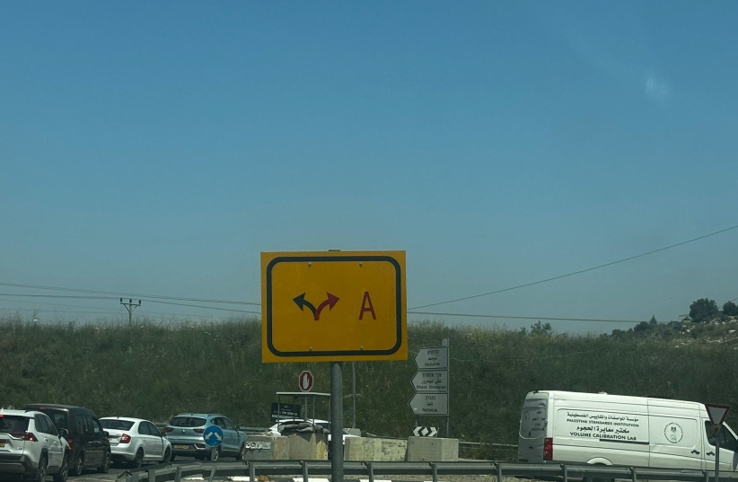
WHILE THE infrastructure hasn’t been improved enough for all the traffic it handles, it has been updated enough that drivers traveling from one Jewish community to another can find their way. Roads are marked by Israeli flags and signs in Hebrew. In some places, the Arabic names on the signs have been graffitied over. Signs also instruct drivers which roads lead to Area A: Palestinian control, and which do not. The goal is to keep Israeli drivers out of Area A, where they are prohibited from going.
There is no real sense of ongoing clashes from a conflict here, but that doesn’t mean there is no conflict. It means the visible sense of it is not as apparent as one might assume. Although the intersections have cement blocks where soldiers could stand, small huts for checkpoints, and barriers that can be lowered, there are very few soldiers visible on the roads. Billboards and signs are in Hebrew and Arabic.
I had wanted to drive up to Sebastia, ancient Shomron, to see if the archeological site had changed.
Once the capital of the Kingdom of Israel, it was founded by King Omri in the 9th century BCE. It thrived for 100 years before being badly ruined by the Neo-Assyrian Empire around 720 BCE. Revived as a regional administrative center, it was improved by King Herod and renamed Sebastia.
The northern Kingdom’s Jewish tribes that had once lived here were gone by that time, and the population was made up in part of Samaritans. The Samaritans revolted against the Byzantines in the 5th century. By the time of the Arab conquests, their population had rapidly declined. Some remain atop Mount Gerezim today.
Despite this rich and interesting history, the landscape here has not inherited many marks of the people who have lived and fought here. The slow attempt to redevelop the site of Sebastia is an example.
I tried to reach Sebastia, but the route appears difficult to find. When one gets to Shavei Shomron, Israeli traffic is directed into the Jewish community. There’s no clear way to get to the archaeological site, except via Area A. Whatever plans are in place to enable the archeological site to be revived have not made it easy to get there, and as the website says, one should coordinate with the army.
I also thought about trying to drive up to Homesh and Sa Nur, the communities near Jenin, which were evacuated during Disengagement, 20 years ago, but are now being rebuilt. It was not clear from the road signs how to get there, so I passed on this idea.
Instead, I headed back towards Huwara and then toward Elon Moreh, where I’d heard there was a good restaurant at Kabir Winery.
The rolling hills here are pretty in spring. The heavy rains of winter have ended. The grass is still green, but it is fading quickly. It will soon become the color of yellowish wheat. The northern West Bank is quiet. There is certainly no sense during the day that there is much of a conflict here. The hills here are steeper than in the southern West Bank. These mountains all have connections to history. Joshua built an altar atop Mount Ebal, and there is a tomb for him near Ariel.
To get to Elon Moreh, the road snakes through open countryside near Nablus. There are Arab villages in the distance, clinging to the foot of the tall hills. The tops of the hills are mostly empty. There are lone trees, olive orchards, and rocky outcroppings. A few grey IDF pillboxes, which look kind of like a giant grey Pringles cylinders, stout towers constructed decades ago to guard some areas, are present at some junctions and a few hilltops.
Not much seems to have changed here. However, the road signs are clear about where to go. Lined with Israeli flags, they show who is in control in some areas. One could be forgiven for feeling there is no conflict, even though these hills are at the center of the long conflict between Israel and the Palestinians.