Road 10: One of Israel's longest roads is one less traveled by

Security restrictions prohibit unsupervised civilian traffic along the scenic 182-km.-long narrow road, but the vistas looking out beyond the border fence into Sinai are mesmerizing.

A SOLITARY car travels north along the desolate road that hugs the border. (photo credit: ORI LEWIS)
A SOLITARY car travels north along the desolate road that hugs the border.
(photo credit: ORI LEWIS)
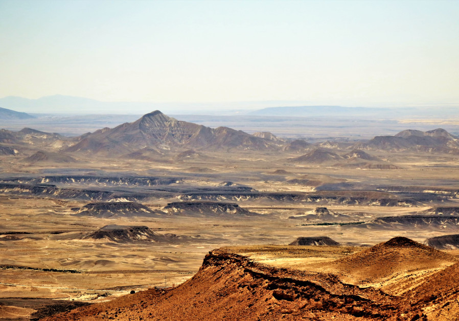
 Road 10, stretching parallel to the border with Egypt, is one of Israel’s longest paved routes, but it is also almost certainly the country’s least-used road and lies in almost complete desolation for most of the year. 
Security restrictions prohibit unsupervised civilian traffic along the scenic 182-km.-long narrow road, which stretches from the southwestern tip of the border with the Gaza Strip, at its northernmost point, to Sayarim junction, about 70 km. north of Eilat, where it joins Road 12, which is also sometimes closed to civilian traffic.
A WIDE-ANGLE view across the border looking at the wastes of Sinai. (Photo credit: Ori Lewis)
Road 10 is peppered with potholes in some stretches, so the aim of getting swiftly from point A to point B is pretty much impossible, but that is hardly the point, because there are very few places that this road will take you to, and it’s certainly not the best Waze option to choose. Anybody who does venture on this road on the rare occasions that it is open is not likely to be in a hurry to speed along it, because the vistas looking out beyond the border fence into Sinai are mesmerizing.
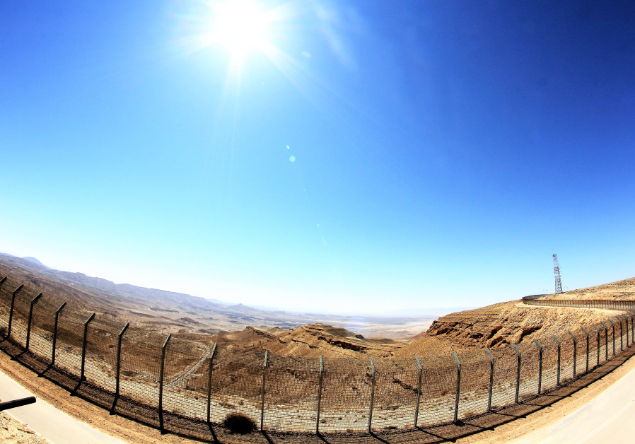
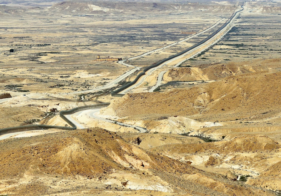
During the temporary opening of Route 10 last month, soldiers stood at roadblocks, checked IDs and counted cars and their passengers in to ensure that everybody could be accounted for when the barriers dropped with darkness and all cars would have to leave. 
Although the route is demarcated on its western side by the imposing, tall steel border fence that is the most prominent man-made feature for miles, in some stretches it appears also to separate two distinctive landscapes, and it emphasizes the geographical differences that become even more apparent between Israel’s Negev and Egypt’s Sinai deserts. 
THE STARK, spectacular landscape typical of this part of north-eastern Sinai that looks almost like an alien planet. (Photo credit: Ori Lewis)
Sinai, in some places, looks like a Martian landscape. For those old enough to have served in the IDF in the territory before it was returned to Egypt, the views will rekindle memories of a time, sometimes fraught with danger, far, far from home and in surroundings that may indeed have seemed to belong to a strange planet, where evidence of life was often nowhere to be seen. By contrast, stretching in the other direction, the Negev appears a more familiar-looking arid landscape with plenty of sandstone features and occasional typical vegetation.
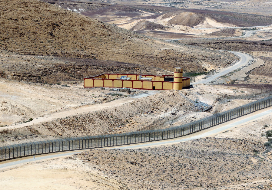
For Israelis looking across into Egypt, about every kilometer, there is a border post housed within a concrete quadrangle for the soldiers who man watchtowers to ensure nobody crosses in either direction. The Israeli lookouts are more discreet and appear less frequently. 
Route 10 used to feature in the news a great deal before the three-year project to build the fence was completed in 2013, because of a number of terrorist attacks that emanated from Sinai.
After almost 30 years following the signing of the peace treaty with Egypt, Israel deemed it vital to erect a contiguous barrier firstly to reduce the terrorist threat; to put an end to the stream of African asylum-seekers and migrants fleeing danger and hardship in their own countries; and stop human sex trade trafficking and drugs smuggling.
ONE OF many identical Egyptian border outposts positioned at regular intervals along the fence. (Photo credit: Ori Lewis)
Immediately after it was completed, the fence drastically changed the security situation, and after several years of calm, the hope is now to open the road more frequently for civilian traffic, although this will depend on ongoing security assessments. 
The route is certainly not the one to choose to get to Eilat, as there are no services anywhere along it, and the nearest civilian communities are distant.
The road traverses what is arguably the most remote part of Israel, and covering even part of it will require a full day’s outing. It is suitable for almost all vehicles, although ones with a high ground clearance are preferable. The journey from the center of the country to Nitzana, on to the road and then off at the Mount Harif exit, about a third of the stretch of Road 10, before returning home, will clock up about 300 kilometers of driving, much of it requiring extra care because of the poor road surface.
THE BORDER fence cuts across the arid landscape. Looking north, Egypt and the Sinai Desert are to the left of the fence and Israel and the Negev Desert lie on its right. (Photo credit: Ori Lewis)
Make sure to fill up the tank all the way and pack plenty of food and water.
Enjoy it when you can. 