 at Naval Air Station North Island, San Diego, California (USA), in June 1940, embarking aircraft and vehicles prior to sailing for Hawaii.")
The wreck of the USS Yorktown, an aircraft carrier that was sunk during the Battle of Midway in World War II, was recently photographed for the first time by the Ocean Exploration Trust.
The site of the wreck was first discovered 25 years ago, during a joint US Navy and National Geographic Society expedition led by Dr. Robert Ballard, president and founder of Ocean Exploration Trust.
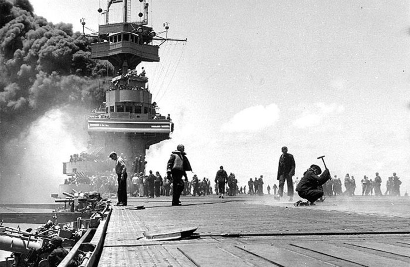
The USS Yorktown sunk after being hit by a torpedo fired by a Japanese submarine during the Battle of Midway in June 1942. 141 officers and crewmen were killed in the sinking of the aircraft carrier.
The dives at the site were launched and closed with protocol ceremonies to honor the site and those who lost their lives on the battlefield. The ceremonies were conducted in ways that reflected their significance to Kānaka ʻOiwi (Native Hawaiian), Japanese, and US military families and communities.
The dive during which the wreck was photographed was conducted as part of a 27-day NOAA-funded mission to collect baseline data to support management in the northwestern part of the Papahānaumokuākea Marine National Monument (PMNM).
The mission also explored the wrecks of the Imperial Japanese Navy (IJN) Akagi and the IJN Kaga.
'Path of the deep sea traveler'
The expedition was named Ala ʻAumoana Kai Uli (path of the deep sea traveler). The name was created in collaboration with the Ocean Exploration Trust, former Kānaka interns at the Trust, NOAA, and members of the PMNM Native Hawaiian Cultural Working Group.
"Ala ʻAumoana Kai Uli speaks to the work that will be done on this expedition, but the name also speaks to the responsibility and accountability that we have to each other in protecting our shared ocean," writes the Ocean Exploration Trust on its website. "The name is a reflection of our collective experiences as people who love and protect the ocean inciting images of physical and metaphoric paths, connecting ocean people to each other and various spaces within the ocean. These paths have been meticulously tended to over time, but the name also reminds us of our continued shared responsibility to care for these paths and our ever-developing relationships."
The monument, which covers over 1.5 million square kilometers, is a UNESCO World Heritage Site and is being considered for national marine sanctuary designation to further safeguard it.