
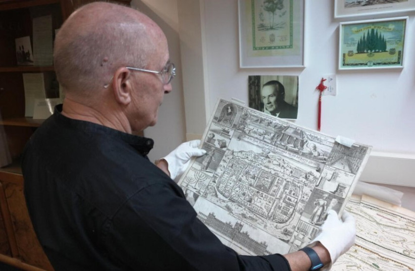
The University of Haifa received the gift of a rare map collection made up of 30 maps and atlases containing biblical illustrations and Christian narratives from the 1500s and 1600s.
The gift was bequeathed by the Richard Umansky Living Trust based on the wishes of the late Dr. Richard Umansky, a pediatrician, outdoorsman, traveler and historian.
Umansky studied the maps for decades and eventually gave them to Stanford University to be cataloged and, when he died, given to the University of Haifa.

One of the maps in the collection is a Dutch interpretation of a 13th-century map, dating back to the 1600s.
Copies of the collection are located in different places around the world.
“We're delighted. It was 20 years ago that I wrote an essay about two of these maps, and now they’re actually here.”
Dr. Zur Shalev
“We're delighted. It was 20 years ago that I wrote an essay about two of these maps, and now they’re actually here,” said Dr. Zur Shalev, head of the Department of General History and the Haifa Center for Mediterranean History at the University of Haifa.
Shalev has found the maps indispensable in his research studying how Christian scholars interpreted Hebrew geographical texts.
“We have maps from German reverend Heinrich Binting, who drew many beautiful maps from the time of the Canaanite people, a Semitic-speaking civilization,” he said. "Binting compiled biblical accounts into a collection of travels. This 16th-century man managed to document long distances in voyages with zero advanced equipment to aid him while explaining the spiritual meaning of Abraham and John the Baptist.”
“Despite previous acquaintance with various parts of the world, maps back then were drawn from the perspective of biblical interpretations rather than physical presence in the drawn location. A cartographer is expected to go into the field and draw based on his voyage.”
Impact of the research
The university noted that the collection provides researchers with the opportunity to study historically significant works, including 500-year-old maps drawn with ancient tools.