
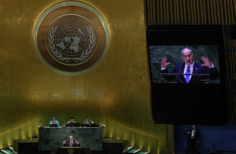
Prime Minister Netanyahu is under fire on social media for holding up a map at the United Nations General Assembly plenum on Friday that placed the West Bank and Gaza within the boundaries of sovereign Israel.
“No greater insult to every foundational principle of the UN than seeing Netanyahu display before the UNGA a “map of Israel” that straddles the entire land from the river to the sea,” the Palestinian Authority’s representative to Germany Laith Arafeh posted on X, formerly Twitter.
With this map Netanyahu negates “Palestine and its people” while “attempting to spin the audience with rhetoric about “peace” in the region, all the while entrenching the longest ongoing belligerent occupation in today’s world,” Arafeh said.
“But as H.E. President Mahmoud Abbas already responded yesterday: “Delusional are those who think peace in the region is possible without the realization of the full legitimate rights of the Palestinian people,” he added.
Netanyahu held up two maps at the UN during his speech. The first was intended to represent the geography of 1948, showing how Israel was alone in the Middle East and had no allies.
Israel was highlighted in green for effect.
Netanyahu unveils 'new Middle East,' but without Palestinians
The second map, which portrayed the year 2023 had seven countries in Green, including Israel and Saudi Arabia. It was meant to illustrate how Israel now had friends in the region and how a normalization deal with Saudi Arabia would expand that.
But the map that Netanyahu used, includes all the territory the Palestinians believe should be part of the borders of their future state. This includes the West Bank, Gaza and east Jerusalem. The latter is under Israeli sovereignty, but the West Bank is outside those sovereign borders. It is divided into three sections Areas A and B which is under the governmental auspices of the Palestinian Authority and Area C, which is under IDF military and civilian rule. The Israeli Right including members of Netanyahu’s government wants to annex Area C. Israel had agreed to suspend annexation plans in exchange for the Abraham Accords.
Netanyahu used the map to illustrate a new era of peace in the Middle East that would include the Palestinians, but his critics said the map sent the opposite message.
Americans for Peace Now CEO Hadar Susskind posted on X that “Netanyahu is returning to his government of fascists, felons, and fundamentalists, which in both action and words contradicts his bogus rhetoric of peace.”
“His map of Greater Israel is perhaps the only honest part of his speech today,” Susskind wrote.
It’s not the only map fiasco of Netanyahu’s trip. According to Ariel Kahana of Yisrael HaYom, Netanyahu had asked for a map of the world to be placed in the room where he met with Ukrainian President Volodymyr Zelensky on Tuesday.
But the map Israel Consulate General in New York brought him, was from the 1960s when the Soviet Union controlled eastern Europe and did not even include Ukraine as an independent country. The mistake was discovered only once the map was in the room and was not used.