
Hundreds of drystone walls located along the length of the Nile River in Egypt and Sudan may be an ancient form of hydraulic engineering, a recent study revealed.
The walls, a type of structure known as a groin (or groyne outside the US), are meant to help give a degree of control over water flow, improving navigation over the river. This may be the oldest such river groin ever found, beating the previous record holder, found along the banks of China's Yellow River, by 2,500 years.
The findings of this study were published in the peer-reviewed academic journal Geoarchaeology.
Don't be in de-nile: Ancient Egypt and Nubia's hydraulic technology on the Nile River
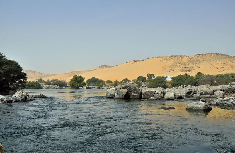
The Nile River is arguably the longest river in the world and its banks have enabled the rise of one of history's oldest civilizations, that of ancient Egypt.
Out of all the great rivers of the ancient world, the Nile was arguably the most prosperous. There are a number of reasons for this, but chief among them is the river's flooding. Most of the ancient river civilizations such as in China and Mesopotamia long had to battle with the tendencies of their rivers to flood. On the one hand, the floods were a good thing because they would provide the ground around them with incredibly fertile soil known as silt. But on the other hand, the floods had the tendency to be erratic, impossible to predict, and incredibly destructive as a result.
But this wasn't the case with the Nile. Unlike the other river civilizations, the Nile was much more predictable. In fact, its flooding was so predictable that it was literally used as the basis for the entire Egyptian calendar, alongside what may also be the heliacal rising of the star Sirius.
It was this predictability of the flooding that allowed ancient Egypt to thrive and become what many have dubbed the breadbasket of the ancient world.
But the Nile is more than just a river in Egypt: It's actually far longer than that.
The full extent of the Nile River stretches all the way down Africa, snaking through Sudan where, at the city of Khartoum, it breaks off into its tributaries: The Blue Nile, which extends to Lake Tana in Ethiopia, and the White Nile, which goes to Lake Victoria, located in Kenya, Uganda, and Tanzania.
While the river itself is very easy to navigate, this is only true for the latter section of the Nile that flows into the Mediterranean Sea, along the banks of which the civilization of ancient Egypt developed.
This is because the rest of the river is divided into six cataracts, a term meant to refer to treacherous shallow waters with numerous stones, boulders, and whitewater rapids.
The first of the six starts at the city of Aswan, which was the ancient Egyptian city of Swenett, and is located sporadically down the length of the Nile before Khartoum.
Below this first cataract was a different region, albeit one that was ruled by Egypt on multiple occasions, called Nubia, which had hosted several different polities throughout history.
And it was here, in Nubia, that the groins were found.
Recounted in records going back hundreds of years, groins were known to have been located along the Nile, with many hundreds of them now submerged beneath the Aswan High Dam reservoir.
However, several more existed. In this study, the researchers mapped out these groins to find out just how far south they went and to see if they could figure out when they were built.
Using drones and remote sensing, the researchers were able to track the groins along an over 1,000-kilometer stretch of the river, going from the first cataract to the fourth.
Using radiometric dating on excavated sites, the researchers were able to date some of these groins back to over 3,000 years ago.
Some of the datings are in line with Egyptian rule over the region, which implies that some could have been built by the indigenous inhabitants, while others were built by the towns made by Egyptian settlement in Nubia.
However, others may have been more recent, with some groins being built in the 1970s and the land made arable by the groins is still used for agriculture.
Other stone walls were also found inside the Nile itself. These walls, which were up to five meters thick and could be as long as 200 meters, acted as barrages. This meant that they were able to direct the flow of the water, which could help boats navigate through the cataracts.
This is in line with other findings, such as ancient inscriptions regarding attempts by Egypt to dig canals to try and navigate the first cataract, or a slipway that was built to allow people to easily drag their boats over land in order to circumnavigate part of the second cataract.
However, dating groins is challenging and it is possible that there were some used even earlier than 3,000 years ago. The researchers noted that the mechanics of how groins would function in providing silt could have been observed by locals in ancient times and could have been emulated as far back as the fourth millennium BCE.
Further investigation of agricultural and hydraulic practices in the region is needed to fully understand just how far back and how sophisticated mankind's efforts at taming the Nile River go.